


Applying new technologies in combination with traditional field mapping to assess the conservation status of marine forests in the French Riviera’s last biodiversity hotspot.
What’s left in the last hotspot of marine forest in the French Riviera?
Academy 3 highlight
MarFor-SPOT will “increase current knowledge of the ecological status of marine forests” and will allow us to detect and better understand the effects of anthropogenic and natural stressors threatening this essential coastal habitat.
The project
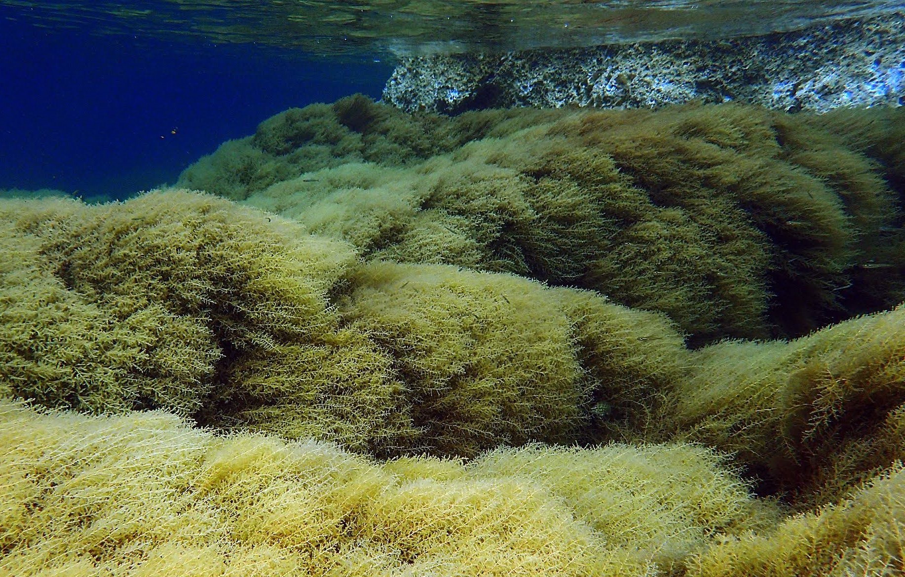
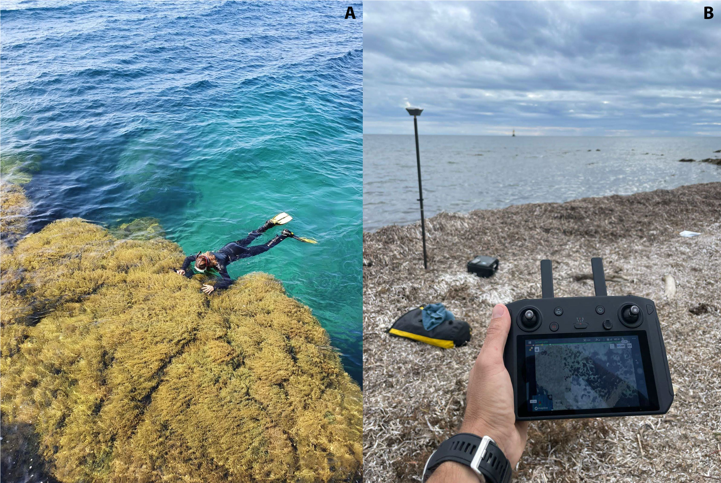
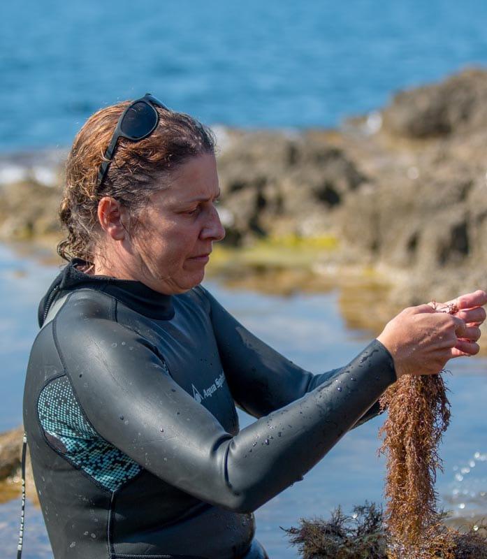
MarFor-SPOT is a project focused on the conservation of macroalgal forests, key marine ecosystems. Macroalgal forests of Cystoseira sensu lato are some of the most productive and biodiverse ecosystems in the Mediterranean Sea. For this reason, most Cystoseira species have been included in different conservation priority lists. Due to anthropogenic and natural stressors, such as pollution, habitat destruction and climate change, marine forests have been largely lost or have been poorly preserved in many areas of the Mediterranean Sea, including the French Riviera. However, their distribution, ecology, conservation status, and the stressors potentially affecting them are still poorly known. In recent decades, severe decline of Cystoseira species has been reported in the French Rivera. In 2022, we mapped the shallow Cystoseira populations along the coastline of Saint Honorat Island, (Natura2000 Site). We found 13 Cystoseira species, highlighting that Saint Honorat is an unexpected biodiversity hotspot in the French Riviera, a highly urbanized region. Some of the species were not previously documented and can no longer be found in other parts of the region. We combined traditional visual census with aerial surveys (drones), to obtain high-resolution georeferenced images that will be used for future monitoring of these important habitats. Drawing on this data, MarFor-SPOT aims at 1) improving the existing distributional and ecological data, 2) evaluating the effects of anthropogenic stressors, and 3) providing management tools for conservation and restoration actions based on new technologies. As performed in Saint Honorat, detailed traditional visual census and aerial surveys will be performed in Saint Marguerite Island and the continental zones of Cap d’Antibes and Cap Ferrat (two different Natura2000 Sites), to provide an accurate baseline map of Cystoseira distribution and conversation status. Given the Mediterranean Sea's vulnerability to climate change, temperature loggers will be deployed in some populations to assess the effects of climate change.
Results obtained in MarFor-SPOT will provide important information on the distribution of Cystoseira species (mapping), their conservation status (anthropogenic stressors) and their sensitivity to climate change (temperature loggers). All this information will represent a baseline for setting up long-term monitoring that will allow a better understanding of the effects of anthropogenic stressors on these essential coastal habitats. The interdisciplinary nature of this project lies in its combination of biology, ecology, geospatial science, traditional methodologies, and new technologies, which allows for a comprehensive approach to study Mediterranean biodiversity and its response to various stressors.
The +
The project allowed us to map shallow Cystoseira sensu lato populations. It provided aerial and georeferenced images of the most ecologically relevant populations in addition to seawater temperatures (hourly records) for the most ecologically relevant populations.
What’s next?
MarFor-SPOT will provide ecological and cartographic information (collected in GIS software) that can be included in a national observation network and databases. This information will represent a baseline for setting up long-term monitoring of the ecological status of the studied habitats. These surveys are crucial to detect and understand population changes driven by current and future hazards and thus to design strategies for optimal management and conservation.
Project information
|
Scientific domain
Marine ecology Environmental Sciences |
Key words Experimental platform Cnidarians Corals Climate change Telomeres analysis |
|
Total budget
€5,876 from Academy 3
|
Students involved
Erwin Raimondet (M1) Margot Clair (M1) Florian Boyer (PhD) |
| Partners ECOSEAS - Université Côte d’Azur, CNRS CEAB-CSIC CoNISMa |
Project members Jana Verdura Luisa Mangialajo Gilbers Romero Fernando Garcia Enric Ballesteros Jordi Boada Margalida Monserrat |
Scientific promotion of the project
- Distribution map of Cystoseira sensu lato forests to be included in a scientific publication
