


Diving [YVDD1] to understand the Mediterranean’s largest tsunamigenic earthquake of the twentieth century: the 1956 Amorgos earthquake, Greece
On the trail of past great tsunamis: Study off the coast of Greece to understand the origin of the Amorgos earthquake and its tsunami.
Academy 3 highlight
This project intends to better understand the “seismic and tsunami hazards of the Eastern Mediterranean” by shedding light on one of the largest seismic and tsunami events of the past two centuries.
The project
A study, conducted by the team from 2013 to 2017 on the fault responsible for the 2004 Saintes tsunami in the Caribbean, highlighted long-lasting traces of past underwater deformation generated by fault slip. While traces of seismic events occurring on land disappear rapidly due to erosion, deformation of the seabed persists longer. It is therefore possible to observe old deformations on the seabed, and thus determine the source of historical tsunamis. The DEEP_BLUE project stems from this observation.
This project aims to understand one of the largest European earthquakes in the last two centuries. On July 9, 1956, off Greece's coast between Santorini and Amorgos, an earthquake greater than magnitude 7 caused the twentieth century's largest tsunami in the Mediterranean Sea. Seismometers were scarce, leading to uncertainty in localizing the quake and fault. Identifying this fault is crucial for assessing seismic and tsunami risks in this tourist region, which hosts more than two million visitors each year.
Previous studies identified three potentially ruptured faults near the earthquake's epicenter. But the characteristics of the tsunami waves, which spread to the Turkish and mainland Greek coasts, suggested there were multiple triggers: seafloor movements generated by fault slip during the earthquake and large underwater landslides.
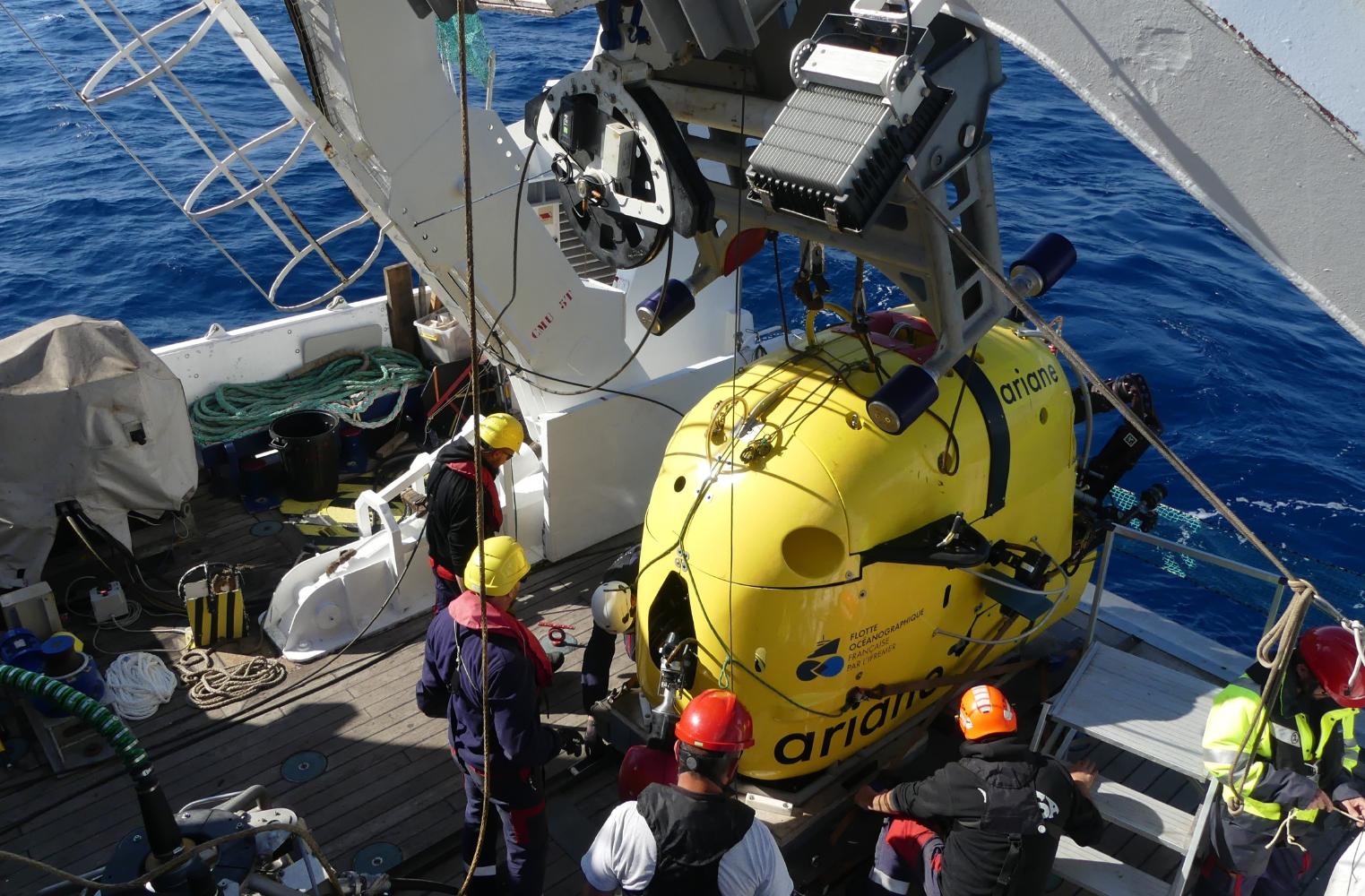
Two missions conducted on the Research Vessel Europe (French Oceanographic Fleet) shed light on these events. During the AMORGOS-22 cruise, a submarine was used to acquire very fine bathymetric data of the three faults, which are essential for identifying ruptures and escarpments on the seafloor. In 2023, the AMORGOS-23 mission, supported by DEEP_BLUE, conducted seven dives with an HROV (Hybrid Remotely Operated Vehicle) equipped with cameras, aiming to observe the seabed and find traces of these events.
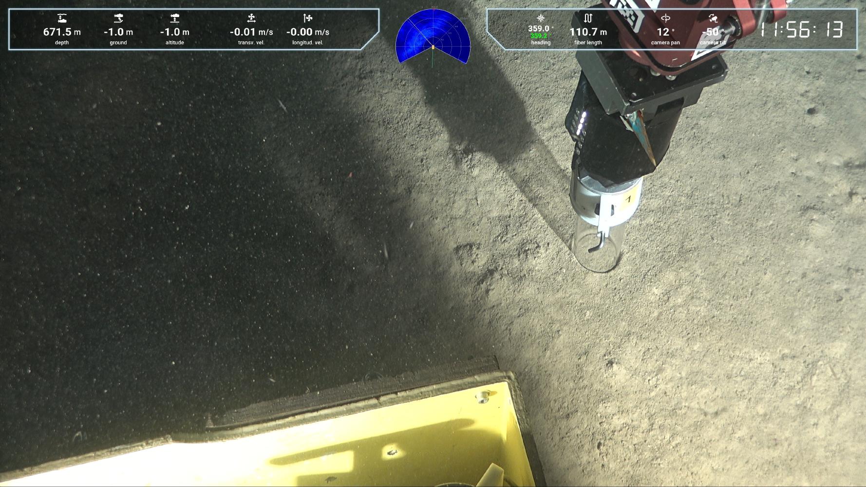
Observations confirmed that one of these faults did indeed recently slip. Since the HROV has a limited field of vision, the video data was subsequently processed by photogrammetry to reconstruct in 3D the outcrops that show evidence of this recent seabed rupture. The slip could be. Sediment cores were also sampled by the HROV to confirm the age of this rupture and to associate these deformations with the 1956 earthquake. This discovery thus challenges the hypothesis that two sources are needed to generate the tsunami, in favor of a single massive underwater rupture of the fault, which could have generated the observed waves.
The +
The results of the two oceanographic campaigns, supported by the DEEP_BLUE project, confirmed that in certain contexts underwater terrains evolve very slowly, thereby making them excellent environments in which to trace the origins of large tsunamis dating back several decades.
What’s next?
Tsunami simulations based on the results obtained will help dispel doubts about the real cause of this extreme event. Research in paleoseismology and the use of new tools in this field could provide a better understanding of tsunami hazard and risk in the Mediterranean. The ANR AMORGOS project, proposed as a continuation of DEEP_BLUE, will address these issues.
Project information
|
Scientific domain
Earth Sciences Seismic Risks Marine Geosciences |
Key words Tsunami Earthquake Telluric hazard Underwater geomorphology Submarine Faults |
|
Total budget
€48,000 including €7,000 from Academy 3
|
Students involved
Sylvain Palagonia (PhD) Eduardo Ochoam (PhD) Danai Lampridou (PhD) Paul Barrière (Student engineer) |
| Partner Géoazur - Université Côte d’Azur, CNRS, OCA, IRD ENS-PSL IPGP - Université Paris-Cité EPOC - Université de Bordeaux, CNRS, Bordeaux INP, EPHE - PSL National and Kapadostrian University of Athens University of Girona |
Project members Frédérique Leclerc Javier Escartin Nathalie Feuillet Paraskevi Nomikou Sabine Schmidt Christophe Larroque Nuno Gracias Alexandre Dano Fabio Manta |

Scientific promotion of the project
- Manta F., Leclerc F., Feuillet. N., Nomkiou P., Barrière, P. , Palagonia S., Escartin J.: Vessel-based photogrammetric reconstruction of a coastal fault zone integrated with bathymetric data: the case of Amorgos Island, F. Manta [et al.] (sciencesconf.org:mdis-2022:423222)