


Source-to-sink sediment transfers and management of hydro-sediment fluxes after Storm Alex in the Roya catchment
Searching for Storm Alex and previous extreme events in a land-to-sea approach
Academy 3 highlight
StS-SEALEX project aims at “better constraining the natural hazards related to storms and flash floods” and providing recommendations to institutional stakeholders on risk mitigation and land use.
The project
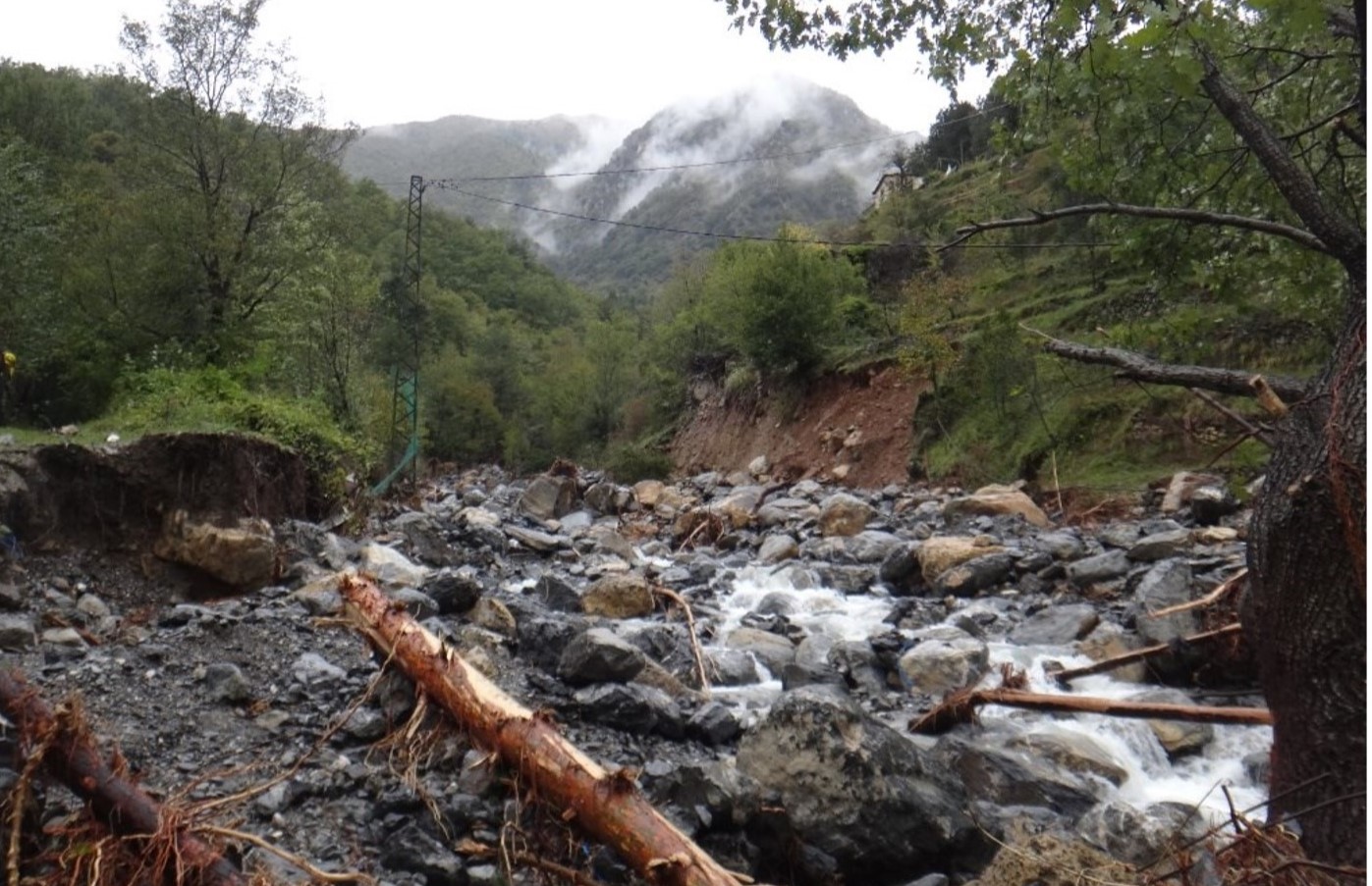
Understanding flood phenomena and characterizing their frequency and impact on populations are major challenges, particularly in the context of climate change. In the Mediterranean Riviera, torrential flooding is caused by exceptional events characterized by intense rainfall, which is accentuated in the catchment areas by steep slopes, narrow valley floors and shallow soils. The large quantities of sediments eroded and carried away during heavy and sudden rainfall make these events particularly hazardous and damaging for the populations of the hinterland. In the context of climate change, such intense rainfall events are expected to become more frequent and even more intense. In the Southern Alps, torrential events of this kind can take place on a regional scale, as illustrated by the floods of June 1957, November 1994, and May 2008, or can concentrate in a few subcatchments (e.g., December 2006, June 2010 and October 2015). The case that interests the StS-Sealex project is Storm Alex, which affected France and more specifically the Alps-Maritime department on October 2 and 3, 2020. The storm generated record levels of rainfall, flooding, erosion and deposition, and landslides and debris flows in the Roya, Vésubie and Tinée valleys: the rainfall return period was estimated to be up to 1,000 years in the Roya. The catastrophic consequences of this storm both in terms of human casualties and damage to infrastructure, have revealed the high vulnerability of this particular area, located between the Mediterranean Sea and the Alps, as well as scientific gaps in terms of fundamental and operational knowledge.
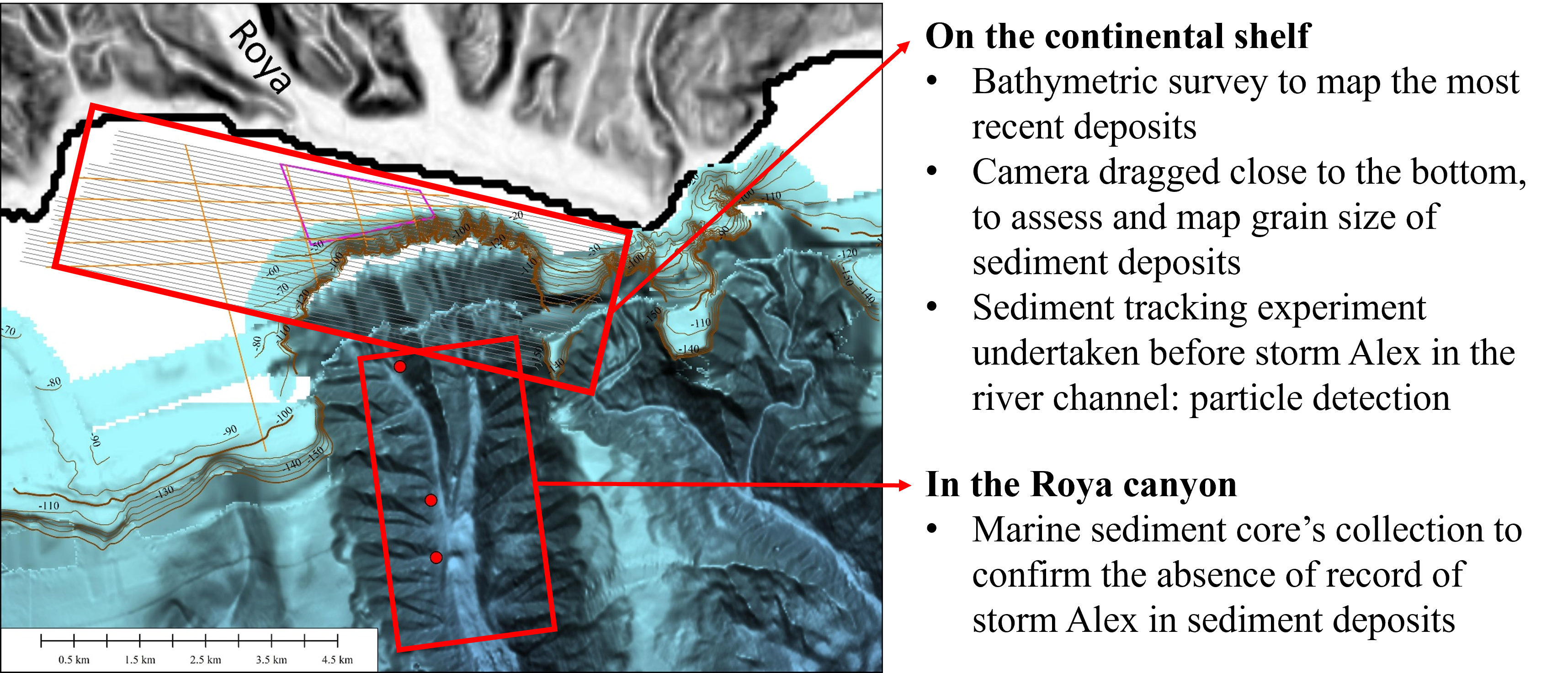
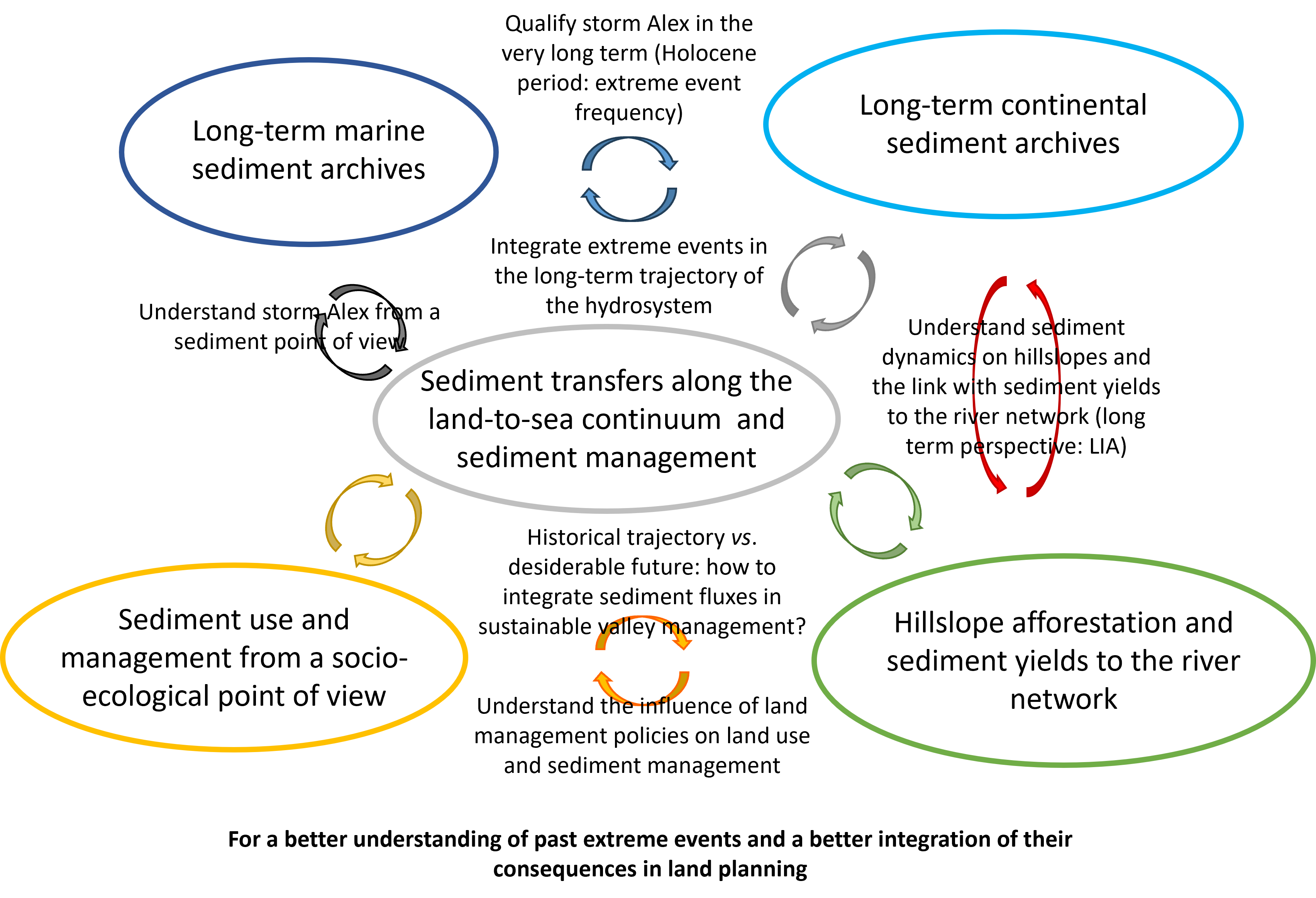
The project aims to better understand the processes of water and sediment transfer at the catchment scale along the land-to-sea continuum over the long term, and to look at how land use and policies affect sediment fluxes. The objective is threefold: 1) to better understand Storm Alex by identifying and analyzing the morphologies and deposits left on land and at sea, and by quantifying erosion rates and sediment transfers between land and sea; 2) to find out how often these events happen by looking at the deposits in the continental and marine sediment archives and then to characterize the link between land use changes and sediment fluxes; and 3) to analyze the impact of government policies on land use and sediment management.
The study focuses on the two catchment areas most affected by Storm Alex (Roya and Vésubie valleys), which provide perfect case studies for the land-to-sea approach thanks to their physiographic characteristics (short river network and proximity to the sea).
To achieve the objectives of the project, an innovative interdisciplinary approach was proposed, combining several fields of expertise in environmental and human sciences, including marine geology (submarine geomorphology and long-term marine records of extreme events), geoarchaeology (agrarian geomorphology and long-term continental records of extreme events), fluvial geomorphology (source-to-sink sediment transfers at catchment scale, sediment management), biogeography (hillslope afforestation and land use change vs. sediment yields to the river network), and socio-ecology (how to build a shared narrative about land planning, sediment use and management). Each field is providing state-of-the-art insights that will be combined at different spatial and temporal scales along the land-to-sea continuum, to gain a deeper understanding of such extreme events and to better integrate their consequences in sustainable land management planning guidelines.
The +
The project is combining a land-to-sea approach applied at several spatio-temporal scales and focused on an exceptional rainfall event, with an innovative interdisciplinary approach that spans marine geology, geoarchaeology, fluvial geomorphology, biogeography and socio-ecology.
What’s next?
This project is creating a new synergy between the partners and will benefit from the contribution of new results obtained from fieldwork and an oceanographic campaign.
Project information
|
Scientific domain
Earth Sciences, Geography, Social sciences |
Key words ALEX storm Sediment Tranfer Extreme events Land-to-sea continuum Risk mitigation |
|
Total budget
€132,100, including €41,300 from Academy 3
|
Start of the project
2024 |
| Partners Géoazur – Université Côte d’Azur, CNRS, OCA, IRD ESPACE - Université Côte d’Azur, CNRS, AMU, AU CEPAM - Université Côte d’Azur, CNRS OFB IMT Mines Alès Université Paris Cité |
Project members Sébastien Migeon Gueorgui Ratzov Margot Chapuis Matthieu Vignal Louise Purdue Gabriel Melun Juliette Cerceau Paul Passy Students involved Ghita Serrhini-Naji (PhD) |
Sébastien Migeon
Géoazur – Université Côte d’Azur, CNRS, OCA, IRD
Margot Chapuis
ESPACE - Université Côte d’Azur, CNRS, AMU, AU
Louise Purdue
CEPAM - Université Côte d’Azur, CNRS
