


The Teil earthquake and fluid circulation in the active fault of La Rouvière
Understanding the relationship between long-term and active fault history by studying mineral crystallization and fluid circulation.
Academy 3 highlight
The level of destruction caused by the Le Teil earthquake was the worst in mainland France since 1967. The scientific and societal interest of this earthquake, which occurred in an area with very high stakes, has led to several research projects studying the “active fault over the long term and the consequences for infrastructures and the population.”
The project
On November 11, 2019, an earthquake of moment magnitude 4.9 occurred near the town of Le Teil (Ardèche, France). Despite its moderate magnitude, the earthquake caused considerable damage near a dense urban area (Montelimar) and two currently operating nuclear plants (Cruas and Tricastin). It was also rather unexpected, as this area had not been identified previously as a high seismic hazard zone. The earthquake therefore represents a major means of raising awareness of seismic risk in mainland France, and as such, Geoazur's geologists and seismologists are playing a major role in analyzing it.
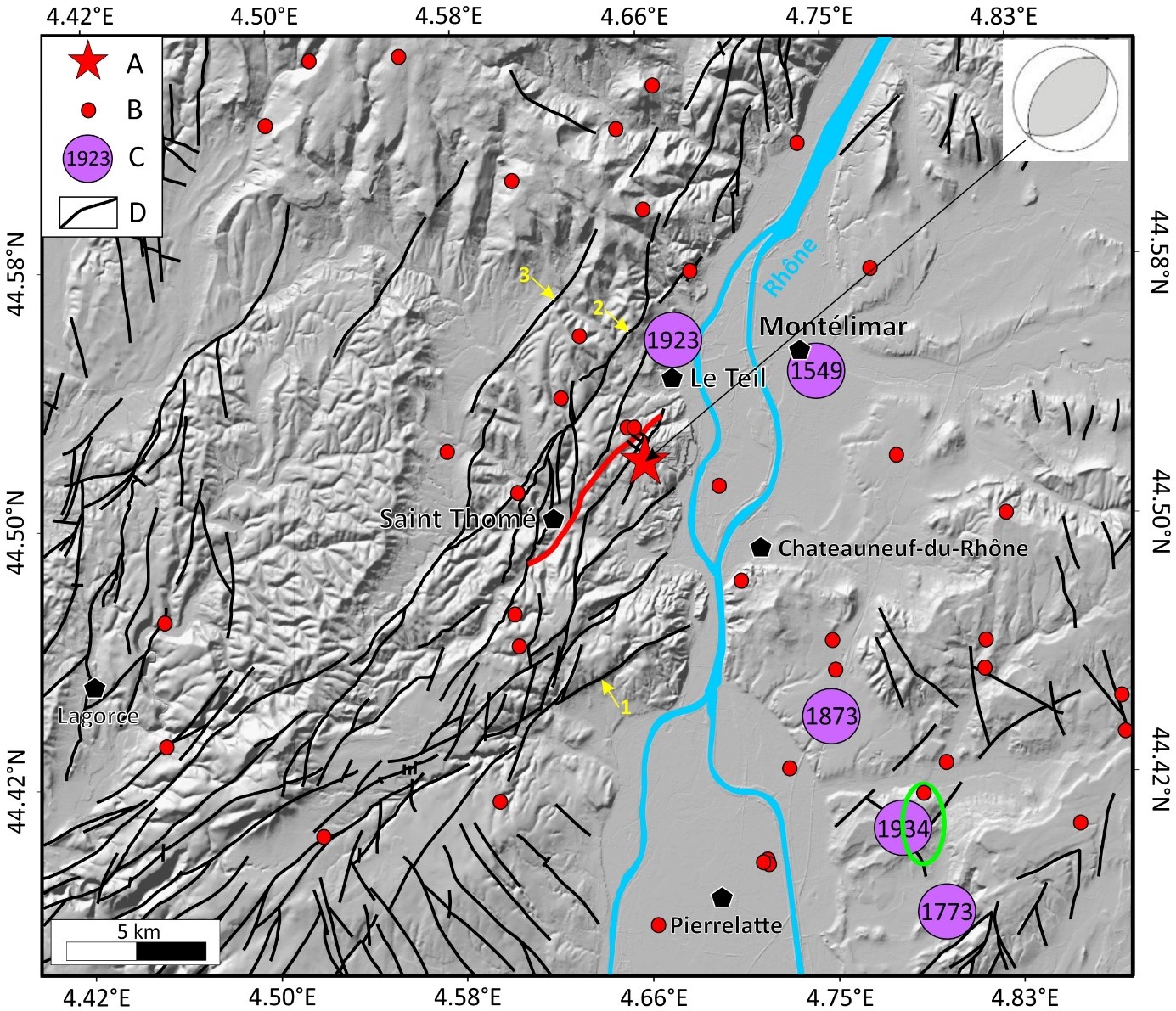
The La Rouvière fault has been identified as responsible for the earthquake. The associated rupture at the surface runs along 4.5 km, with a hypocenter located at very shallow depth (~1 km). This provides a unique opportunity to analyze the relationship between geological attributes of the active fault and the seismological parameters of the earthquake.
The major question we are trying to address in this project is how such a significant earthquake was able to nucleate inside rather soft clay-rich rocks, at such a shallow depth.
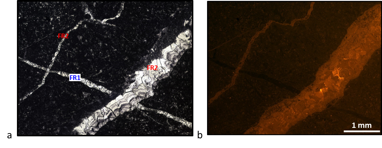
For this purpose, we are analyzing samples retrieved from a borehole drilled at about 30-meter depth through the La Rouvière fault. These samples are used to characterize the microstructures of fault-zone polyphasing (as calcite veins or pyrite minerals). Each generation contains information on all the episodes of deformation along this fault and on the origin of the fluids involved in the deformation/mineralization.
As part of this project, we have been able to complete the geochemical analysis of these minerals, measuring stable isotope ratios of Carbon and Oxygen using an ion microprobe instrument located in the Géoressources lab (Nancy). With these isotope ratios, we can determine the origin (shallow or deep) of the fluid circulating through the fault during these mineralization phases. We can also trace the evolution of fault permeability, which is an important parameter to better understand what triggered (human-induced or naturally) the Le Teil earthquake.
The +
The project combines the study of the microstructures of mineralized veins and the geochemistry of crystallizations in post-earthquake active fault samples. The relationship between long-term deformation and active faulting is also being analyzed on a fault in a stable intracontinental domain.
What’s next?
The studies carried out on the samples from this first borehole drilled through the La Rouvière fault will enable us to calibrate our analyses for the rest of the project. This will involve drilling, for the first time in the world, at hypocentral depth, in other words in the zone where the seismic rupture started in 2019.
Project information
|
Scientific domain
Earth Sciences Seismic Risks |
Key words Faults Microstructures Geochemistry Earthquake |
|
Total budget
€11,000, icluding €2,500 from Academy 3
|
Students involved
Maïlys Bouhot (M2) |
| Partners Géoazur - Université Côte d’Azur, CNRS, OCA, IRD GeoRessources - Université de Lorraine |
Project members Christophe Matonti Christophe Larroque Aude Gebelin Jean-Paul Ampuero |