About this module
Exponential demographic growth and rural-to-urban population migration are inducing widespread land use/cover changes (LUCC).
Urban expansion onto agricultural and natural areas modifies infiltration and runoff processes and exposes greater numbers of people to more risks, particularly in regions of the world where land planning legislation/implementation is weak or absent.
After an overview of the global and local drivers and trends in land use change, the module will focus on different approaches to model LUCC.
Learning outcomes
On successful completion of this module students should be able to:
- describe the major factors driving LUCC at global and local scales
- explain techniques to quantify and map LUCC
- produce LUCC models at different spatial and temporal scales using GIS
- model complex spatial dynamic auto-organized phenomena
- simulate land use and land covers changes with GAMA platform
- assess future scenarios of natural and urbanized area
Learning approach
This module is project-oriented and includes a mixture of theory and practical work.
Theory: Fundamental Processes, Mitigation Strategies, Early Warning Systems.
Practical work: a case study that exploits the power of GIS to map and predict LUCC
Topics Covered
- Global importance of LUCC and drivers of LUCC
- Land use and cover change modeling
Module Head

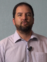
Matteo CAGLIONI
Engineer in Environmental Management and Urban Planning.
Head of Department of Geography, Urban Planning and Sustainable Environment at Université Côte d'Azur.
Main teaching and research fields: Urban Modelling and Geosimulation, Artificial Intelligence in Geocomputation, Smart Mobility, Geographical Information Science, Spatial and Data Analysis, Big Data and Volunteered Geographical Information, Ontology and Semantic Enrichment of 3D City Models.
RESEARCH GATE


